

Getting to
Riparbella.
A hilltop town little more than an hour from Tuscany’s main cities, with nine free parking areas spread along the ridge. No restricted traffic zone, no traffic, nothing to worry about.
Where are you coming from.
Riparbella is reached from the Cecina Nord exit of the SS1 Variante Aurelia, then along the SP 13 del Commercio. Here are approximate driving times from the main Tuscan cities.
Nine areas, all free.
Riparbella has no restricted traffic zone: you drive in, park and explore the town on foot within minutes. The old town stretches in a line along the ridge, and the car parks are marked with the letters A–I from south to north. It is worth choosing the one closest to whatever you want to see first: tap a card and the map centres on it.
Riparbella in practice
A medieval hilltop town stretched along a ridge of white tufa at 216 m above sea level, in the province of Pisa, between the Val di Cecina and the Etruscan Coast. It grows in a line along the ridge — not on a circular plan like the neighbouring towns — with 13 murals in the old town, nine wineries in the countryside and around 65 km of green trails.
Getting here
| By car | Exit at Cecina Nord on the SS1 Aurelia / Variante Aurelia, then SP 13 del Commercio . Cecina 10 km (15′) · Livorno 50 km (45′) · Pisa 65 km (55′) · Volterra 35 km (40′) · Florence 130 km (1h 45′). |
| By train | The nearest useful station is Cecina , on the Pisa–Rome Tyrrhenian line; from there you continue by bus, taxi or hire car. The Cecina–Saline di Volterra railway is not in service and is replaced by buses: the San Martino stop is therefore not a useful arrival point. |
| By bus | Riparbella is served by regional bus routes with their terminus in Cecina: up-to-date timetables and stops at at-bus.it. |
| By bike | Anello del Vino : 42 km and around 1,000 m of ascent taking in the nine wineries. Bike racks in the old town and e-bike charging points. |
Car parks — all free
You can walk across the town in a few minutes: leave the car in one of the car parks along the ridge. On the map they are marked with the letters A–I from south to north, and every card has a direct link to Google Maps.
- A · Via delle Mura — the first one you come to arriving from the south, from the coast.
- B · Via Carlo Alberto Dalla Chiesa — the lower part of the town and the Church of San Giovanni Evangelista.
- C · Via della Fonte Vecchia — the central car park.
- D · Via degli Orti — central area, a few steps from the Town Hall.
- E · Via della Grotta — the largest, on the north side: a flight of steps leads straight up to Piazza della Madonna.
- F · Oliveta car park — north side, along Via Roma.
- G · San Rocchino — next to the park and the tabernacle of San Rocco.
- H · Cemetery area — handy for the Monumental Cemetery.
- I · Sports ground — during festivals it is normally reserved for campervans.
The murals
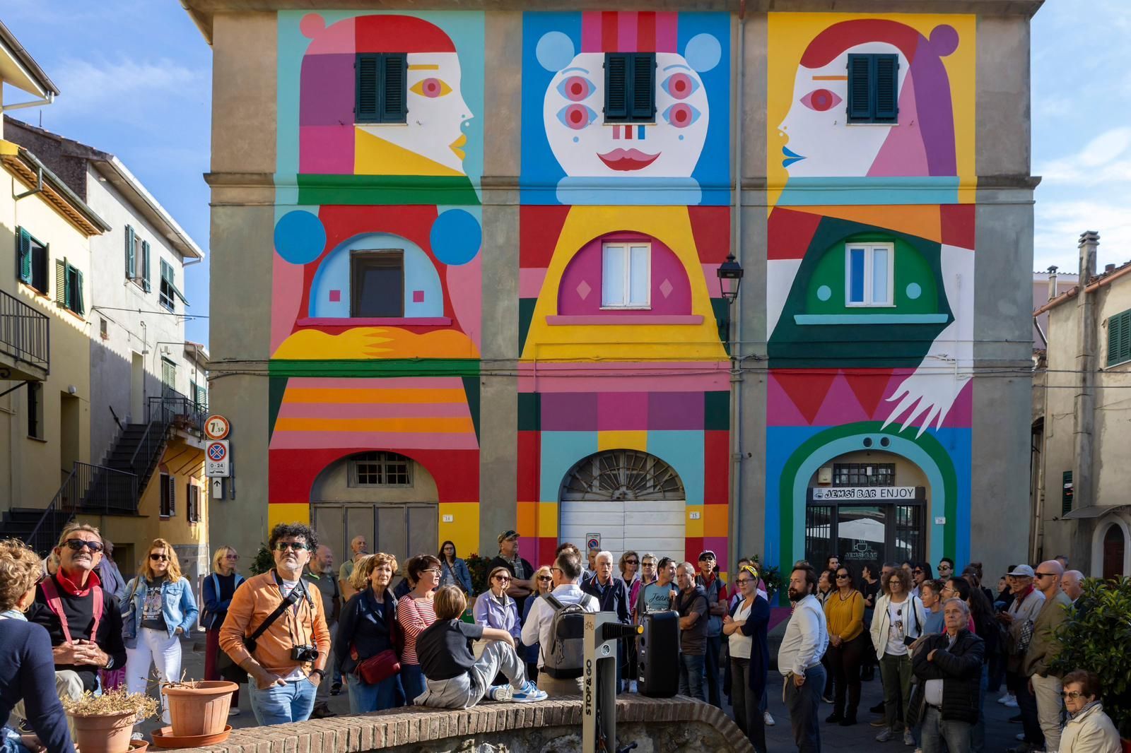
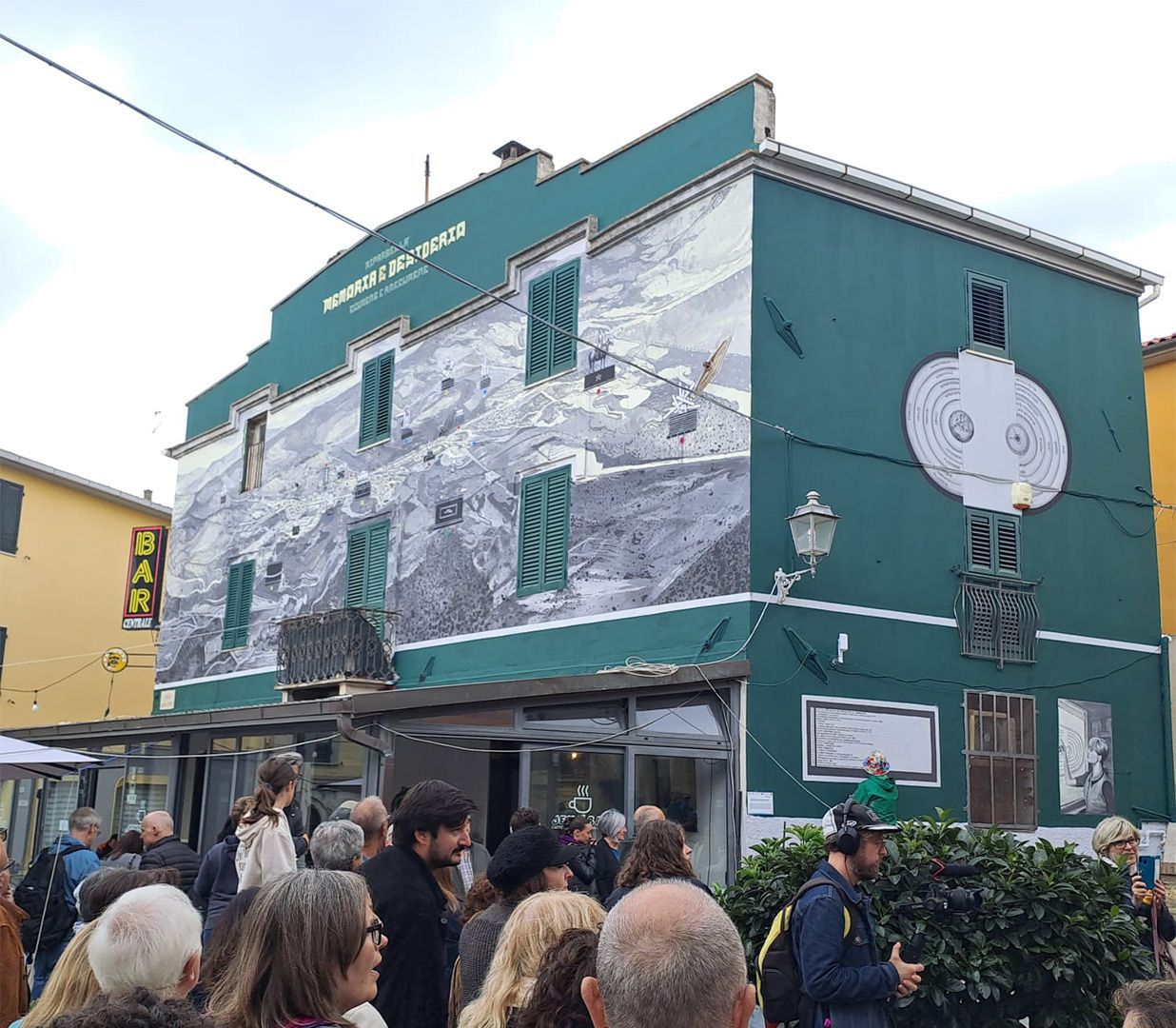
There are 13 so far : every year, on the last weekend in September , the festival La Collina delle Fiabe adds new ones. They are painted by international artists working with residents and with the owners of the walls, and each one tells a story about Riparbella or is connected to the town in some way. You can see them all on foot in half an hour, all in the old town, along with the twenty hand-painted artist benches .
The project was started in 2018 by the municipal administration with the association StArt Attitude and funding from the GAL Etruria, with the idea of turning the town into an open-air contemporary art museum. You can follow the route on your own with the map from the tourist office, or join a guided tour led by volunteers.
Useful numbers
Tourist office / Town Hall
Piazza del Popolo 1 · 0586 697111
Municipal pharmacy
Piazza Matteotti
Carabinieri
Riparbella, north side
Tourism portal
visitriparbella.com
Regular events
| 25–26 April | Pianeta Ripa |
| May | Ripa Fiorita — flowers and tradition. From May, Via di Piazzetta becomes the street of coloured umbrellas |
| 24 June | Night of San Giovanni |
| July | Ripa Wine — wine and music |
| early August | Agrifiera |
| late August | RipaTalent |
| last weekend in September | La Collina delle Fiabe — street art festival: the new murals are created |
| November | Sagra del Cinghiale wild boar festival · Festival of Tradition and New Olive Oil |
| December – January | RipaChristmas and the Mechanical Nativity Scene |
How to use the map
- Tap a category at the top : the map frames those points and the list opens.
- In the old town, points close together are grouped into a circle with a number : tap it to open it.
- On every card the button Take me there opens navigation in Google Maps.
- With the crosshair button, top right, you can see where you are in relation to the points on the map.
Data sources
Content from the Riparbella tourist office and the portal visitriparbella.com, data from the BiciInComune app and base mapping by OpenStreetMap. The car park locations are those given by the tourist office. Some points in the centre have a position estimated along the street from the house number: their card says so.
By bus or by bike.
The nearest useful station is Cecina
Riparbella has no working station. You arrive by train at Cecina, on the Pisa–Rome Tyrrhenian line, and carry on by bus: CTT Nord services link Cecina to the town in about twenty minutes and stop in Piazza Matteotti, in the old town.
There is a Riparbella stop on the old Cecina–Volterra line, at the end of an avenue of cypresses in the Cecina valley. Rail services on that stretch are, however, suspended since 2020 and replaced by buses: it is not a useful arrival point.
Up-to-date timetables and stops at at-bus.it and Trenitalia.
Cycle tourism in the area
The town is crossed by cycle routes linking the Etruscan Coast to the hills of Pisa. Among them is the Anello del Vino wine loop, which takes in the nine wineries of Riparbella with around 1,000 metres of ascent.
On the map above, under Trails, you will also find the other twelve walking and mountain-bike routes in the area, with their starting point, length and ascent.
For those arriving by bike there are racks at several points in the old town and two e-bike charging stations, shown on the map under Services.
Tips for events.
During the busiest events of the year — Sagra del Cinghiale, Ripa Wine, Ripafiorita, RipaChristmas — the central stretch of the SP 13 del Commercio is closed to traffic. On those days it is best to use the car parks at either end of the town: A and B arriving from the south, G, H or I arriving from the north.
Arrive early in the morning or in the late afternoon and you will find a space easily even during the festivals. The town can comfortably be seen in a day , but those who stay the night discover the most authentic Riparbella: the one of summer evenings in the little squares.